Showing posts with label Ride Review. Show all posts

Thursday, October 21, 2010

Day 6: Natchez Trace Self Contained Ride

Today was another day of wonderful weather that was simply ideal for cycling. I was up about 7:00am and on the Trace by 8:00am. Shortly after leaving Colbert Ferry, I crossed the Tennessee River. My photos do little justice to the wide expanse and grandeur of the river. As a cyclist, it is a simple matter to dismount and linger a few moments to absorb and enjoy a sight. I snapped more pictures and considered again what a great day it was to ride. If fact, any day you ride your bike is a great day.

Shortly after crossing the Alabama – Tennessee state boundary, I encountered two southbound cyclists on a truly marvelous adventure. Jay and Ginny were from Seattle, WA. They had started their odyssey in early September. An Amtrak train brought them eastward to Albany, NY. Car rides took them to Canada where they rode from Quebec down the north side of the St. Lawrence River to Montreal and again to Washington, DC where they rode the C&O Towpath northward, connected with the Great Allegheny Passage and rode that path to just south of Pittsburgh, PA. Another car ride took them to Nashville, where they started their southbound trek on the Natchez Trace. The ultimate destination on this fine October day was the city of angels (Los Angeles, CA) in time for Thanksgiving.

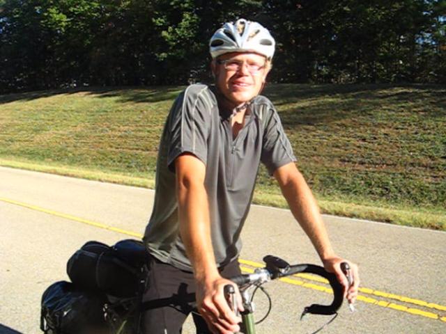
They were clearly serious and committed riders, but toted the most unconventional gear. . . buckets! Mounted on their seat post brackets, Jay pointed out that one should never leave home without one’s bucket. While on the bike, the buckets provided storage for their sleeping bags. Once stopped a bucket was a seat, a wash tub for clothes and body. Buckets propped up bikes when repairs were necessary. Jay and Ginny also pulled BOBs that included inflatable air mattresses. All the comforts of home!

We chatted some more, wished one another happy cycling and then pedaled away down the open road.

Not much further down the road I encountered J.D. Robb walking the Trace. John, a former Wall Street trader from Dallas, noted that he had walked the Appalachian Trail (Trail Name “Hell on Bad Wheels”) and now had a goal to become the first person to hike all 11 national scenic trails and to do so for the benefit of others who are in need. Visit his website TrekkingforaCause.com and click on the link “See all updates from BadWheels' Journal.” John completed his Trace trek about month after we met. With or without a bucket, amazing things are possible!

Mile 352: Stopped at McGlamery Stand to risk a climb up a fire tower noted in Wanner’s book. Wanner’s warning is “climb at your own risk.” My recommendation is don’t even attempt an accent. The wooden stairs are missing and a successful scaling of the metal apparatus has two chances…slim and none! I diverted my attention to wandering the recently decorated graveyard at the base of the tower.

Back on my bike, I pedaled on to Collinwood for lunch. Collinwood is one of the few towns immediately adjacent to the Trace.

Mile 345: I lingered in the Wayne County Visitor Center in Collinwood for quite some time. Betty, a volunteer there, took me on a delightful tour of the center. Swapping stories of adventure, Betty related how she and her husband had once built a boat and floated/motored down the Mississippi and in-land waterways. Included among the artifacts at the center is the poster for a 1960 Zachary Scott movie. The Turner Movie Classic website gives a synopsis of the film:

“In the 1830s, in the wilderness area between Natchez, Mississippi and Nashville, Tennessee known as The Natchez Trace, ruthless highwayman and slave trader John A. Morrow robs and kills travelers. When Morrow kills a plantation owner, the man's daughter Sue and her fiancĂ© Russ conspire to stop him. By volunteering to become one of Morrow's band, Russ learns that Morrow plans to build an empire of thieves and become their dictator. Eventually Russ thwarts Morrow's plans and causes his downfall.” A thriller, I am sure.

Lunch was at Chad’s Family Restaurant. Re-supply was at the local Piggly Wiggly.

Mile 363: I stopped at the Sweetwater Branch historic site and engaged in a lengthy conversation with a Dallas-based gang of friends touring the Trace in their large RV. I asked if I could see the inside of the RV and was warmly welcomed. We chatted and idled time away without a care for time or distance. I asked, “How far do you travel each day?” The response was, “Sixty miles.” My retort, “Me too.” I further asked when they planned to be back in Dallas. "Whenever." Good answer.

Mile 375: The best part of my tour without question was my short departure from the Natchez Trace to ride a section of the actual old Natchez Trace. A small section, about 2.5miles, of the old Trace is sufficiently paved to support bike traffic. This short ride gave a real sense of what it must have been like to travel the Trace so long ago. Deep woods and the sounds of birds and other animals provided a sense of isolation. Could the original engineers who labored to open this road in the late 1700’s ever image that one day a carbon fiber bike carrying a spandex-clad rider would make use of their labor? Don’t miss this Trace adventure!

Encountered several long climbs this day that required looking for lower gears. All doable.

Mile 385: The ride to the camp sites at the National Park Service Meriwether Lewis campground was longer then I had anticipated (.4 miles). The campground is named for the Meriwether Lewis of “Lewis and Clark” fame. In October 1809, Lewis was found dead of a gunshot wound in what was then call Grinder Stand. A large monument in Pioneer Cemetery marks the spot of his grave. A replicate of Grinder Stand is located nearby.

I set up my tent among a sea of RVs and discovered the gang of four riders whom I had met earlier at Colbert Ferry. There was more lively conversation that evening; my last evening on the Trace.

Total Mileage 65 / Average 12.3

Tuesday, October 19, 2010

Day 5: Natchez Trace Self Contained Ride

An excellent night’s rest at the motel. This evening was originally planned as an outdoor stop at a bike only campground at the visitor center, but commonsense gained the upper hand during my pre-trip planning. The one night at the motel was a pleasant respite. The motel also provided the opportunity to dry out my gear, do some laundry, eat something other than Ramen noodles and take a nice hot shower.

Camping has its advantages in having one’s “own place” and offered a ritual of camp set up/break down that helped mark the end and beginning of each day’s adventure. The National Park Service campgrounds are free and my only private campground at Ratliff Ferry cost $5.00.

The National Park Service campgrounds were conveniently located directly on the Trace had clean comfort stations and offered great opportunities for socializing with fellow travelers…but they did not have showers or electrical outlets. The lack of electrical outlets at campgrounds required that I husband the battery power of my Blackberry. Phone calls were made when necessary as was the checking and sending emails.

In evening, I would set my music app to shuffle and listen to some tunes as I ate dinner and wrote in my journal….but I had to kept this simple pleasure to brief periods. Now both I and my Blackberry were fully charged.

I rolled out of bed at 8:00am and chose a simple breakfast of coffee, juice, waffles, bagels, etc offered at the motel. There were many breakfast options in walking distance from the motel including a IHOP.

When I returned to the Trace at about 9:00pm, I lingered at the Natchez Trace Visitor Center for about an hour. A very well spent hour. The visitor center has a great set of displays providing the history of the Trace and surrounding areas. My frequent stops at historic markers and this visitor center visit really helped me appreciate the history of the Trace. I was back on the road by 10:00am.

Mile 269: I stopped at the historic marker noting the grave site of 13 unnamed, fallen Confederate soldiers. A solemn site. It is wonderful that respect was paid so many generations later to these soldiers of long ago, whose lives slipped away maybe due to injury or disease at this very spot. Gone but not forgotten.

While visiting the grave site, I struck up a conversation with Dale and Floyd two brothers on a two-week motorcycle tour of the Trace. Floyd was a retired university professor; Dale had had a career in HR that allowed him to travel the world. Among the delights of a solo, self-contained ride is that you can schedule, plan or do any dang thing you like. At this moment, spending 30 – 45 minutes chatting away with Dale and Floyd seemed like just the thing to do.

They were also kind enough to snap of few photos of me riding my bike on the Trace. We parted each “motoring” north in our on fashion.

On my way to Pharr Mounds, I stopped at historic markers including Dogwood Valley, Twentymile Bottom and Donivan Slough. The view from a short climb required at Twentymile Bottom was an excellent investment in energy and strain.

Mile 286: Pharr Mounds is the site of a series of earthen mounds built my native North American Indians of long ago. One needs to pause a moment to truly appreciate the enormous energy and organization required to move earth basket-by-basket to build such mounds. Those builders are long gone...but there work remains...hmmmm...what will we leave behind?

Pharr Mounds was my lunch stop. There are no services at this location so the meal I carried of fig bars, fruit and remains of a small loaf of bread was my fare. There was more conversation with families and couples traveling by car or RV.

Mile 302: I visited Tishomingo State Park which is a short ride off the Trace. It was here 10 years ago that I "survived" a poorly organized solo August Trace century ride. From that experience, I have always been keen to fill water bottles and take advantage on long distance rides of watering opportunity when they arises . My reserve water bottles tucked in my BOB netting can be directly related to that ride a decade ago.

The flat terrain of southern Mississippi was now giving way to more climbs as I left Mississippi and touched of bit of Alabama. Again nothing comparable to the miles of climbing up the gaps in my beloved North Georgia, but I was working for my miles. Miles 313-315 were clearly mentioned in my ride journal.

Mile 311: I met Alex, 23, who was a south bound rider headed to New Orleans. I later encountered his traveling companion Reed some miles down the road at Colbert Ferry. Alex was pretty impressed that an "old guy" of 59 was on a self SAG the Trace.

Mile 327: I arrived at Colbert Ferry around 5:00pm and found the ranger/visitor center "closed for the season." I also found and chatted with Alex's riding partner Reed who was re-fueling and preparing to push off to meet Alex in Tishomingo.

I made a very limited attempt to find the bicycle only campground at the Colbert Ferry. I was by myself and the picnic tables near the ranger/visitor center were an allure. The restrooms were open at the ranger/visitor center providing access to water. I pitched my tent against the ranger station and started to fix my dinner.

As I was fixing dinner, four 20 something cyclists rode down the Colbert Ferry entrance road. They set up camp in the nearby bicycle only campsite. I visited later that evening. The group was composed of two couples John, Mary Catherine, Jessica and Bill from Memphis. They were on a self SAG ride of the Trace. It was nice to have evening company and enjoy an engaging conversation.

Dinner this evening was a Pad Thai noodle dish I purchased at Kroger earlier that morning. It was delightfully tasty, filling and a nice break from my regime of noodles/rice.

Total miles 67 / average 12.7 mph

Monday, October 18, 2010

Day 4: Natchez Trace Self Contained Ride

There were few services available near the Trace for this day’s ride, so I filled all my reserve water bottles and made my supply of snack food handy. There will also be no restaurant lunch stop today.
I used my REI-purchased web nettings that secured my sleeping bag to my seat post rack and my BOB water proof bag to store my copy of Wanner's guide book, water bottles and snack supply. Although I had a handle bar pack, I carried my map, Blackberry and other light articles in the pack. I found the netting provided the easiest and quickest configuration to access gear.

I had developed a ride sheet for this tour using Wanner's books, material from the National Park Service, Internet searches and material from other cyclists who had completed a Trace tour. My ride sheet primarily outlined my evening stops, water and food sources, bike shops, ranger stations and the occasional point of interest. I used Wanner's book on the tour primarily to add more "color" to the historic marker information and help explore off Trace services. Although, as I noted in earlier blogs, Wanner's off Trace directions did not float my boat.

I left Jeff Busby around 8:30am under overcast skies. The Trace road surface again returned to a smooth riding surface. The terrain was flat with only slow moderate climbs. There was little to no traffic. And everywhere it appears the Trace was immaculately manicured; no road side trash, grass well trimmed…a wonderful sense of being given a treasure to cycle. I also had a chance to walk a section of the Old Trace.

Mile 233: Historic markers visited before pulling into Witch Dance included Pigeon Post, Line Creek and Bynum Mounds. Witch Dance has a nice comfort station, picnic tables, camping facilities and trail head for a horse trail into the Tombigee National Forest. And how can one not stop at a location name "Witch Dance?" The National Park Service signage relates that:

"The very name conjures visions of eerie midnights, swirling black capes and brooms stacked against a nearby tree. The old folks say the witches gathered here to dance and wherever their feet touched the ground the grass withered and died never to grow again. Impossible? Maybe so, but look around. Look for a hidden spot where no grass grows."

I had lunch and then stretched out on a picnic table for a short nap that was soon interrupted by rain drops. The dark clouds from the morning had lingered so I reconfigured my bike for foul weather and got my Gore Tex rain jacket at the ready. More dark clouds gathered, more rain threatened. It was going to be what it was going to be. I got back on the Trace on my way to Tupelo. This evening's stop was a motel in North Tupelo.

Despite the threat of rain, little fell so I continued my stops at historic markers that included Chickasaw Agency, Hernando Desoto, Monroe Mission Station, Tockshish, Chickasaw Council House and Black Belt. The information at these historic sites continued the story I had read earlier. Changes in road making, traffic, the introduction of the steamboat and Indian removal had diminished the importance of Natchez Trace as a key thoroughfare for commerce.

The Natchez Trace was resurrected by Congressman Jeff Busby of Mississippi who proposed a parkway as a way to give tribute to the original travelers and the importance of this forgotten highway in the development of America.
The Daughters of the American Revolution extended the commitment to remember our past by placing monuments along the trace. The picture to the right is one such monument near French Camp. The Civilian Conservation Corps form in the Great Depression surveyed the route in 1934. Construction began in 1939.

My “rain luck” held the last 33 miles to Tupelo. Rain clouds remained north of me making the road wet when I arrived, but keeping me relatively dry. Near Tupelo (mile 250 – 260), there was heavy traffic and a great deal of Trace construction. Daylight had dimmed considerably. I was disappointed in myself when I noticed a southbound cycling couple pass me with their front head light set to flash mode. I rode with a red rear flashing light, but still had my headlamp in my BOB waterproof bag. Dang.

By mile 261, I could feel the pull of the motel and warm bed pulling on me.
Mile 266: Mile 266 is the location of the Natchez Trace Visitor Center. But the threat of rain and fatigue helped make my decision to end the day's ride. During my trip planning, I had booked the hotel room at the America's Best Motel (662.842.4403; 897 Harmony Lane, Tupelo, MS) based on a recommendation from Wanner’s guide book. I turned right just at the Natchez Trace Visitor center to head to the hotel. I needed assistance from the Blackberry GPS to finally navigate across business N. Gloster Road to the motel. Blake, the hotel manager with whom I had booked my room by phone,was there at check in. Just a wonderfully warm and caring person.

As I closed the door to my motel room, the heavens opened with a heavy and continuous downpour. I headed for a hot shower and rest before venturing out for dinner.

The motel is in the heart of a mall shopping district with plenty of restaurants and a Kroger grocery store. I was able to do laundry at the motel (needed to supply my own detergent). A well deserved steak dinner with a beer or two at Logan's Roadhouse (walking distance) was followed by a very restful night’s sleep.
Total Mileage: 75 / avg 13.6

Sunday, October 17, 2010

Day 3: Natchez Trace Self Contained Ride

Morning opened with the sounds of pickup trucks with boat trailers in tow arriving for an early fishing day start. I had breakfast, packed and was on the road by 8:15am.

Kosciusko, 36 miles down the road, was my planned lunch stop. Historic stops included Choctaw Boundary, Robinson Road, Red Dog Road and Myrick Creek.
I meet my first fellow Trace rider, Ursula, this day. Ursula, a 30-something southbound rider, was riding what can best be described as a “Wal-Mart” blue-light special bicycle. Her front-mounted wire basket was more suited for a beach-front day rider than a long distance cyclist. Ursula was on an adventure from her home in Michigan to Santa Fe. She related how she had previously done a solo ride in 2001 from Michigan to San Francisco... a testament to her determination and pluck. We chatted and then parted ways.

Around mile 150, I encountered road crews repaving and patching the Trace. Most the Trace road surface is smooth and easy riding. But it was clear from this section with its as yet un-repaired roadway, how damaged the road surface had become. I was thankful that the Trace was under such concerned stewardship.

From mile 160 to 192, the silky smooth road surface changed to a chip and tar surface. The surface was not a bone jarring shake-and -bake, nor was it terribly rough, but the smooth tire humming I had come to enjoy was gone. The weather was also overcast and threatening. Thankfully, blue skies returned by mid afternoon.

Mile 160: I stopped at the Kosciusko Visitor Center just off the Trace and picked up a local map. The volunteers at the visitor center were very gracious and pointed out that a nearby Wal-Mart would be a convenient re-supply stop for food bars and fruit. I had lunch at a Subway near the Wal-Mart. I felt "spent" at this lunch stop. I had not been pushing hard and the terrain was relatively easy riding. I suspected I was not putting enough "fuel" into myself at breakfast and made a note to increase my morning food intake.

During my trip planning, I continually searched to find the balance between carrying food/supplies and frequently re-supplying along the Trace. Services directly on the Trace do not exist. Wanner’s guidebook was an excellent resource for locating services such as restaurants, stores, water, bike shops or lodging off the Trace. A packet of information provided by the National Park Service also contained good reference material. Just call 800-305-7417 and indicate you plan to cycle the Trace and the NPS will mail you information.

My final plan included carrying a week’s supply of instant coffee and oatmeal for
breakfast. Lunch was planned as a stop in a small town restaurant. I carried a two day dinner supply of dried, instant noodles, foil packets of chicken or tuna. I reasoned that if something went wrong with planned stops, my two-day supply of dinners would become lunch and dinner fare. Each night I prepared dinner with my Whisper Lite stove.

For water, I carried two bike-mounted water bottles and two one-liter soda bottles on my BOB that I fully or partially replenished depending on anticipated access to water. Several years prior to this trip I rode a solo one day century on the Trace in August. Big mistake! Thirty-five miles into my 50 miles out/50 miles back ride, I realized I had far too little water for the blistering heat in which I was riding. But the only water to be found was 15 miles further down the road in Tishomingo State Park. This trip, with Wanner’s book and the National Park Service information, I had very good intelligence on where to find water along the Trace. During day rest stops I added apples, oranges and food bars found during shopping trips off the Trace.

After lunch at Subway, I was back on the Trace. The environment along the Trace was changing from Spanish moss-draped trees to pines and hardwoods. Historic stops include Hurricane Creek, Cole Creek and Bethel Mission which told and re-told how traffic along the Trace ebbed and flow with the fortune of one town becoming the misfortune of others.

Mile 180: French Camp, just north of the Trace historic marker, is a complex of restored buildings housing a gift shop and the Council House restaurant. After a nice rest and walk about at French Camp, I pushed the final few miles to the National Park Service campground of Jeff Busby. When heading north, be prepared for a long climb starting at mile 189 and a nice downhill at mile 190.

Mile 193: The three National Park Service campgrounds are free and very well maintained. As the literature from the NPS indicated, the service station/store at Jeff Busby was closed as of October 2011. But water was available from the comfort station. Showers, however, are NOT available at any of NPS campgrounds. Nor did I ever find, despite continuous efforts, a place to plug in my mobile phone for recharging. These are two improvements I hope will be made to facilities in the future.

After setting up camp I took a stroll up to the mountain top outlook. There is a small display center and a wonderful view. The fall foliage was a wonderful display of color. It was a very pleasant way to end another wonderful day of cycling.

I typically look for a campsite near the comfort station and off the campground perimeter. I am also keen to take note if a nearby RV has an external gas power generator set up. The NPS campgrounds do not have hookups, so many RV owners run a generator at night. It’s lights out and quiet by 10:00pm, but it is a comfort to have dinner without a humming generator filling the dinner hour.

Dinner was Ramen noodles, tuna, fruit and a cookie left over from my Subway stop.
Total mileage: 75 / average 13.2 mph

Saturday, October 16, 2010

Day 2: Natchez Trace Self Contained Ride

My first night on the Trace at the National Park Service (NPS) Rocky Springs was a bit cool. I packed a three season sleeping bag and sleeping bag liner. This combination of sleeping gear provided a range of comfort for unpredictable fall weather patterns. I also had a full body ThermalRest sleeping mat. My pillow was a stuff bag with a fleece liner that I filled with a small inflatable pillow and my other clothing. Overall this equipment provided comfort with only minimal carry weight.

I was up around 7:00am. Before breakfast, I walked up the hill to the location of the now long-gone town of Rocky Springs for which this campsite is named. The only remains of this city are two old, rusting metal safes (sans doors), a few water cisterns and a Methodist Church. The church had been active up until a few years ago. Now it stands as a silent guardian over the souls buried in the nearby graveyard.

The history of the Trace contains abundant evidence of the impact of passing time has on lives. As foot and commercial traffic patterns changed and as technology such as the steamboat became commonplace, towns along the Trace flourished and then ebbed out of existence. To those of us with memories of “I like Ike” (1950’s) , there was a similar eclipse of small town motels and businesses as the interstate highway system wound its way in all directions across America. The “internets,” as former president George Bush would note, drove yet another transformation of traffic. I suspect all is just the natural order of things adjusting and re-adjusting.

All these thoughts flooded me as I walked back to my campsite along an original part of the Natchez Trace. I was walking the same ground that so many Kaintucks had trod more than two centuries earlier. Sometimes letting one’s imagination have free rein is the natural order of the day.

Back at camp, I made my breakfast using my Whisper Lite to heat water for oatmeal and coffee. I found later in the week that my “normal” portion of oatmeal was insufficient for the day’s ride. Note to self: double breakfast intake.

Based on my riding experience from the previous day, I re-configured my bike packing. My Trek 5500 is a carbon fiber road bike without grommets for panniers. I had attached to my seat post a small rack on which I secured my sleeping bag with a elastic net that I had purchased from REI. A second net was used to secure my water proof bag to the BOB (vs. the cross cords provided with the BOB). These REI-purchased nets were an excellent addition to my riding gear. Light weight, easily reconfigurable to lash things to either bike or BOB, they offered a simple mechanism for storing things such as food, water or clothing in an easy-to-reach fashion. Highly recommended.

I attached my red flashing light to the net holding my sleeping bag to the seat post rack and was on the road by 9:00am. The next planned stop was Clinton, 34+ miles away. It was a 68 mile day, so I rode a pretty steady pace in the morning, but still stopped at historic markers along the way - Choctaw Boundary, Dean Stand, Battle of Raymond. These stops offered a mini history of the Trace and a chance to allow newly consumed information to swirl and mix with my thoughts as I rode. A Trace ride, in my humble opinion, would be incomplete without such fare.

This is on the only section of the Trace where traffic is a problem. Between mile 80 and 105 there is a fair amount of local traffic. In this stretch, the Trace has access to I-16/I-55. Locals from Jackson and Clinton use the Trace for their daily commute route. Caution and a flashing rear light are recommended.

Mile 89: Pulled off the Trace into Clinton and stopped at Lenny’s Sub Shop for a lunch break. Following lunch was a visit to the welcoming Clinton Visitor Center.

The visitor center has some very nice displays of local history items and lots of “stuff” for sale. The visitor center, which attracts a great deal of auto traffic from the Trace, also has signage reminding motorists of the state law to maintain a three foot clearance from cyclists; a nice touch.

Day cyclists were abundant on Trace this weekend day. A multi-use trail near the Trace also was filled with walkers, runners and other cyclists. I took a “purist” position and opted to stay on the actual Trace rather than ride this parallel path.

Back on the Trace, I rode with a steady flow of traffic for 13 miles to MS 51. I exited the Trace at MS 51 and headed for a large supermarket .3 mile from the Trace as indicated in Wanner’s guidebook. My evening campsite was a private campground (Ratliff Ferry) that advertised a store and restaurant, but I suspected the "restaurant" would be no more than a burgerand beer depot for fishermen launching their boats. My re-supply list included fresh fruit and carrots.

Again, Wanner’s off-Trace directions were difficult to follow. After exiting, the Trace directions indicated I should “head south toward Jackson.” There was no signage and as far as I could determine, the road ran east-west. But this trip was an adventure, so I turned left at the first traffic light, School St., and Mac’s Fresh Market and a small shopping center were found, supplies acquired and I was back on the Trace.

Traffic started to thin as the Trace hugged the rim of the huge Ross Barnett reservoir. The sky was a clear blue, road smooth, pleasant weather….a perfect postcard day for a ride.

Mile 122: The last tourist stop of the day was the Cypress Swamp. The swamp is a look back into a more primordial time with languid waters gently lapping against sprawling root systems of ancient cypresses. I strolled the wooden walkway around the swamp preparing to venture a bit deeper into the interior of the swamp when a local noted if I were “lucky” I may be able to see the gators that call this swamp home. Hmmm… I snapped a few more photos from the security of the wooden walkway and proceeded down the Trace to Ratliff Ferry campground.

Mile 123: The signage to Ratliff Ferry campground was quite visible from the Trace. The campground is located at the very end of the road adjacent to the parking lot where a boat launch ramp is located. The restaurant/store is located off the parking lot as well. My expectation that it was a burger/beer depot proved correct. I arrived just before closing time of 6:00pm, paid my five dollar camping fee and bought a beer. When in Rome...

As I left the store, a dozen Harley hogs were pulling out of the parking lot that stirred the air within my lungs with their deep-throated engine roar. I was not sorry to see them leave.

The primitive campsite is just an open patch of land adjacent to the parking lot. There were trees for shade, a picnic table for dinner and large white 50 gallon plastic trash container with the re-assuring message in block lettering “NO FISH GUTS.” Life could not be better.


Separate restroom and shower facilities were available. The restroom adjacent to the campsite/parking lot was pretty clean. It had a reliable source for drinking water and provided a safe haven for my food bag in the evening. The showers had hot water, but the whole shower experience was pretty primitive.

The shower room was located a very short walk in a nearby complex that offered long term single and double wide trailer placement. Here, flags with the US stars and stripes flew proudly with flags of the Confederate stars and bars. Burgers, beer, Harleys…what else would one expect?

The evening settled on the water way and I settled into my dinner and journal writing.
Total mileage: 75.5 / avg 12.9 mph