Thursday, June 7, 2018

King of the Mountains

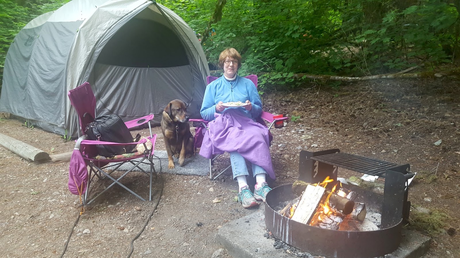
Helen Eating Dinner
Colonial Canpgrond
We woke at our campsite at a US National Park near Lake Diablo, high in the Northern Cascade Mountains. We have become accepting of this season’s unusually cold temperatures ranging in the mid 50s to low 40’s. The previous evening we made dinner then sat around our campfire for warmth.

The big event today was Jay riding 65 miles over Rainy Pass and Washington Pass. The first 33 miles consisted of continuous climbing. The cumulative uphill climb was 5,700 feet (a mile is 5,280 feet) and 5,157 feet of descent.

Given the mountainous climbs, Jay left camp early and Helen spent another hour cleaning breakfast dishes and packing up the Prius.

We are now writing this blog at day’s end at a KOA Campground in Winthrop. Jay confessed it was his toughest day of cycling.  North Georgia mountains are challenging, but climbs are only in the 8 – 12 mile range.  Thirty-three miles of climbing presented him with a new challenge.

Crater Peak
From Jay Bike Route
His strategy of slow and steady was put to the test today. After 15 miles of climbing, he switched his bike’s computer from mileage to time. Ride for 15 minutes then rest. Repeat.  With this timed strategy he finally arrived at snow-covered Rainy Pass. The final ascent to Washington Pass was much steeper.  Fifteen minutes became 10 minutes, but eventually the mountain’s peak was reached.

Snow On Road Side
Near Rainy Pass
Despite the stress of such a strenuous climb, there was time to “smell the roses,” or more appropriately, gaze at the snow- covered Northern Cascade Mountains. We are east coast Appalachian Mountain people; west coast Rocky Mountains have a soaring majesty that doesn't compare. Jay’s frequent rest stops gave him an opportunity to absorb and incorporate these mountains into his life experience.

Helen had the more mundane duties today of packing up, finding food and acquiring new campsite for this evening.

During dinner of turkey tacos, Jay remarked that the idea of doing this ride solo and self-supported in retrospect looks pretty crazy. However, our hats are extended to our church members and friends Keith and Marcia who did such a trip on their tandem bicycle. What an adventure they had!

We are now planning how to cross the final set of Washington State mountains. We think it will take about five days to reach the Washington – Idaho border.

 More Photos
View of Mountains on Jay's Ride

Lake Diablo

Big Foot Footprints on Highway

Mountains Crossed - Mountains to Cross


Sunday, June 3, 2018

Rain Delay

Day 4 of the great bike ride across America was halted by a rain delay.

Earlier during our car travel we regularly checked weather reports due to the ever-present grey skies in Washington.  We would check the Weather Channel website and sure enough, no rain was predicted. True to predications sunshine joined us.

Interesting face on a quilt
Click to enlarge all photos 
So when we woke this morning at Deception Pass State Park with dark skies, we said, “Hey, sunshine will join our travels today.”

Jay started his 50-mile ride, first heading north up the west side of Fidalgo Island. Once in Anacortes he would turn east towards our day’s destination in Concrete, WA.  Helen, in the Prius with Nando, stopping to visit the Textile and Quilt Museum in La Conner.

A bit more than an hour later, phone calls were exchanged, discussing the constant falling rain. Jay paused his riding in Anacortes, WA and took refuge in a donut shop. Helen backtracked and joined Jay. We booked a pet-friendly room in the San Juan Motel.

In the center of town, near the water
The advantage of this motel was that it was close and relatively inexpensive. The room was spacious but bizarrely configured with two bedrooms with a small galley kitchenette between the rooms (no dishes or silverware).  Jay spent a goodly amount of time getting the internet and TV to work. At least we were dry and comfortable.

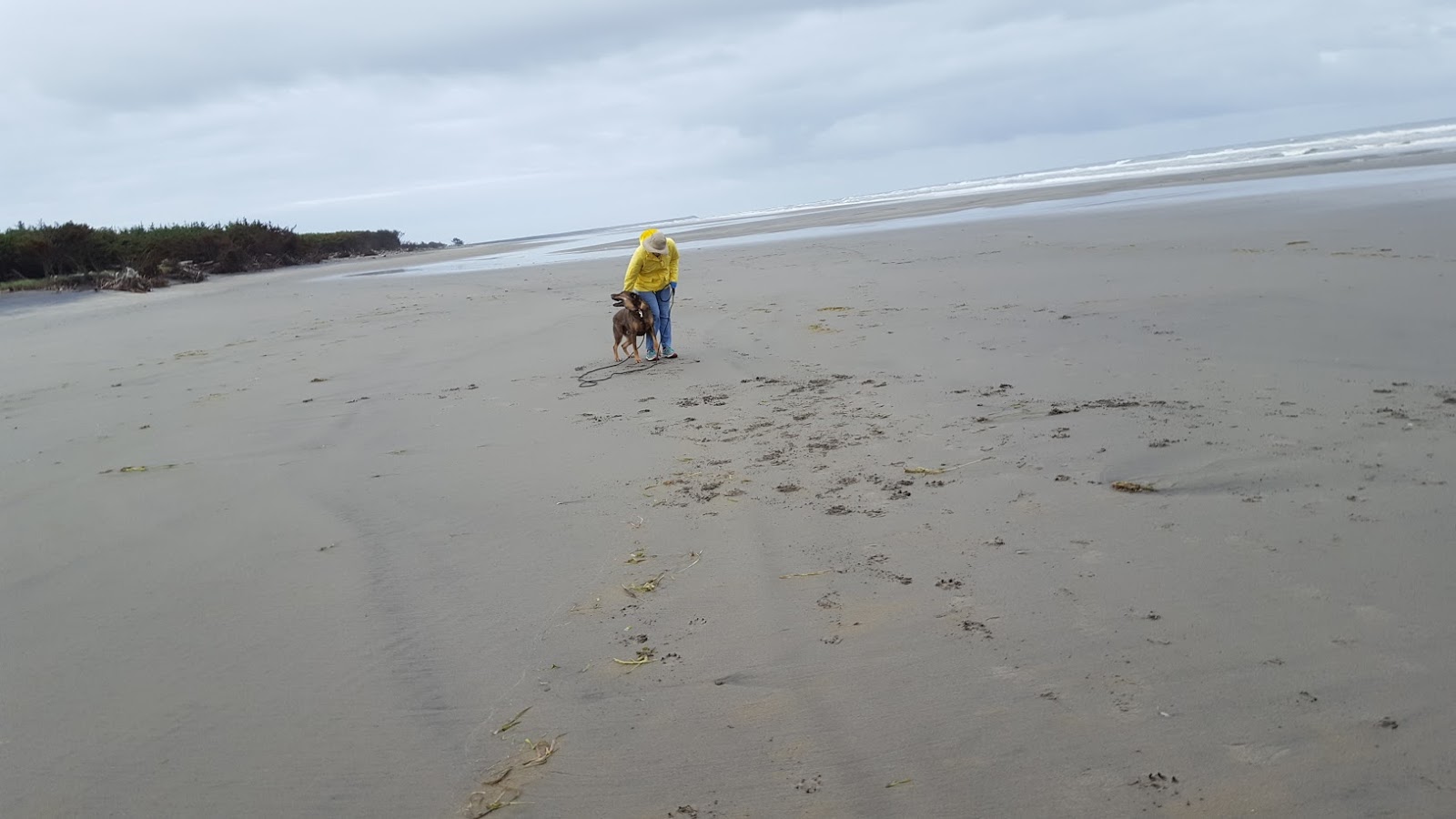
Walking on the beach in Anacortes, WA
We are in the early phase of our bike ride adventure.  From our car camping experience coming out to the west coast we developed a good routine of setting up our tent. With Jay riding and Helen driving, we now have to plan each day differently. Jay checks his maps from Adventure Cycling to determine a day’s riding distance. We then explore potential campsites at end of his day’s ride.

We are doing okay, but have room for improvement. Camping at Deception Pass State Park was recommended to Helen as she did laundry before catching the ferry to Fidalgo Island.  She called Jay to divert him from Fort Ebey State Park and to continue further north to Deception Pass. “Roger Dodger.”  When Jay arrived at the popular state park there was only one tent site open (with over 220 sites). That open site was due only to a recent cancellation.  Yikes!

Jay’s ride is taking on a different dimension as well. At first he rode the traffic-free Olympic Discovery Trail; now he is on busy highways some with limited shoulder space. The sense that this a “long" bike ride has not yet penetrated his thinking. Rather, he sees each day’s ride as just a day’s ride surrounded by wonderful landscape and sometimes lots of traffic.

More Photos (click to enlarge photos)
Olympic Discovery Trail
Deception Pass

West Coast of Washington State

Nando on his Bed


Saturday, June 2, 2018

The Game is Afoot

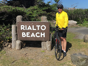
The great cross-country bike ride began on May 31, 2018 at 10:00 am Pacific Coast Time. We have no set time schedule, but suspect we will be in Savannah, GA in late July or early August.

Jay At Start of Ride
Click to Enlarge
The start of the ride began at Rialto Beach, WA.  After a hug and kiss from Helen, Jay pushed off.   This ride will be a scenic tour of America one spoke at a time. As we did on our drive to the west coast, visiting roadside Americana and chatting with people along the way will be our top priorities.

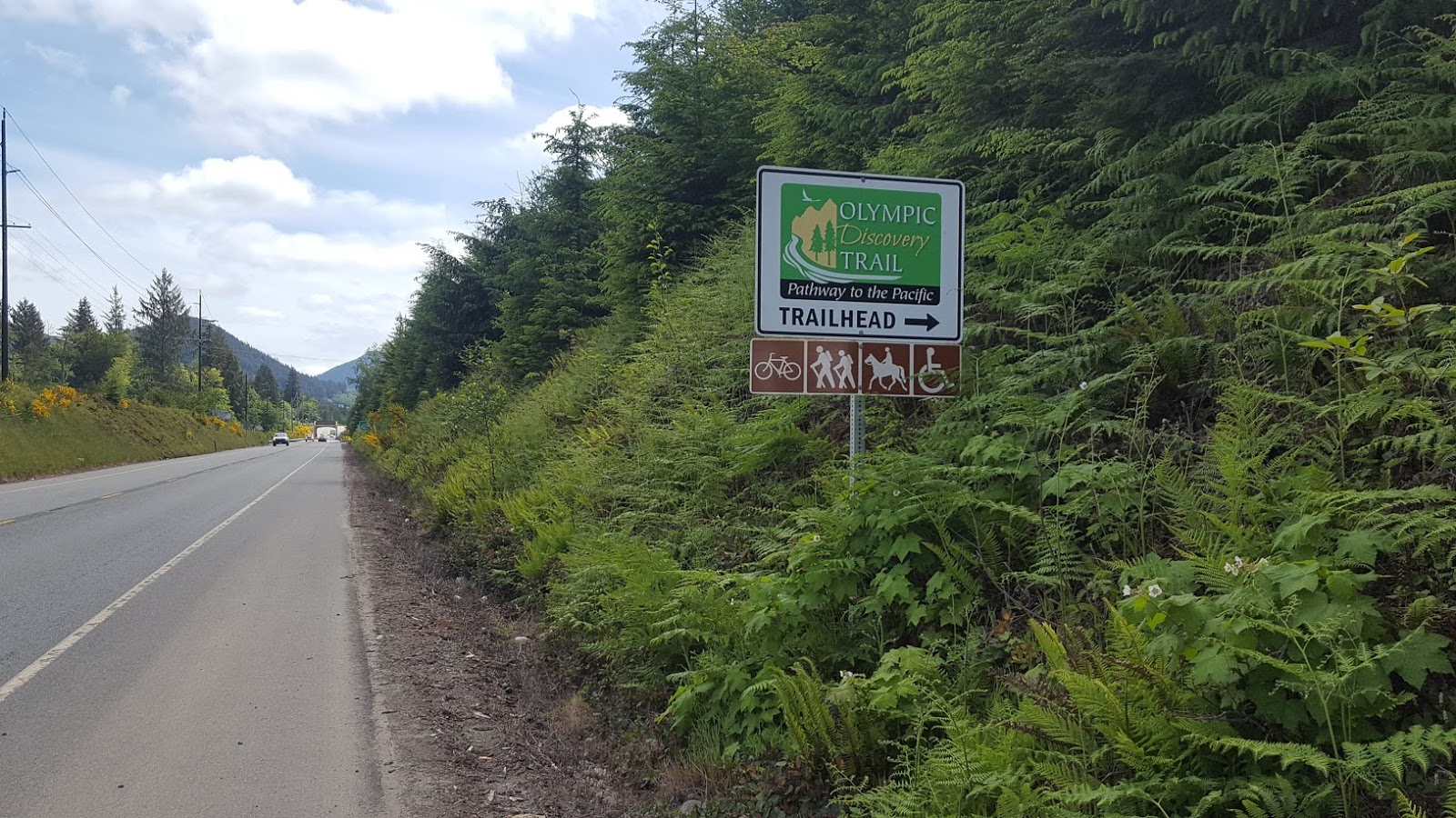
Jay’s Day 1 ride was 45 miles.  Most of today’s ride was on the Olympic Discovery Trail (ODT). The ODT runs from our start location eastward to Port Townsend, our jumping off place, before joining up with the Northern Tier Bike Route from Adventure Cycling.  The trail sometimes is a low traffic road and sometimes a dedicated no motorized vehicle use pathway.

Part of the Olympic Discovery Trail
Jay concedes he had no great epiphany or insight.  Rather, under overcast skies, he pushed along, following and crossing rivers, riding the canopy of overhanging trees or along desolate stretches of road that only occasionally were punctuated with a fully load logging truck.  The take away from Day 1 is that America is indeed a beautiful country endowed with a cornucopia of natural wonder!

The start of Day 2 from the moss-covered trees in the Fairholme Campground in Olympic National Park could best be described as “you can’t there from here.”  Jay’s Google route noted that he would be on the Olympic Discovery Trail; the view of the local environment gave him pause.  The day before his Day 2 ride he drove the car on his intended northern bike route.  The road, initially paved, turned to packed gravel (still okay). The road then turned into an unimproved dirt road (bad).  The signage indicating “Road Closed” was the deal breaker.

Road Construction on 101
The southern route on the 101 was undergoing extensive road construction, so Helen drove Jay and his bike to another access point on the Olympic Discovery Trail.  Perfect riding followed.

When entering the western suburbs of Port Angeles, the ODT transverses a neighborhood of upscale home with manicured
Xeriscape Lawns
Port Angeles
“lawns.”  The lawns were mostly xeriscape (rocks and low bushes).  Jay also noticed that at the trailhead parking lots he saw Priuses, Subaru Outbacks and other mileage-friendly cars.  The same observation held true for vehicles in Sequim (pronounced squim), WA.

In our northern Atlanta suburban home, SUVs and trucks are the norm.  It appears that social norms here are more aligned with our desire to be earth friendly.

More Photos
Olympic Discovery Trail Signage

Olympic Discovery Trail
Deep in the Woods

Lake Crescent Seen From
Olympic Discovery Trail


Roadside Pies, Bread and Cookies

Wednesday, May 30, 2018

Spotted the Pacific Ocean

Today’s target was La Push, WA, the designated jumping off point for the bike trip.
Nando and Helen
Click to Enlarge
However, rather than pulling into La Push, we pulled into Cape Disappointment State Park near Long Beach, WA.  We set up camp and then took a walk on a long, wide and dark-colored sandy beach with the Pacific Ocean lapping at our feet.  After thirteen days of meandering across this beautiful country we finally arrived at our destination to start Jay’s bike ride back to Savannah, GA.  Well, we almost arrived.

Long Beach, WA
World's Longest Beach
Cape Disappointment became our day’s destination when Jay googled campsites in La Push.  Employing knowledge from his pre-trip planning, he thought La Push and Long Beach were “just a few miles” from each other.  Either city would be just fine for a jumping off place. So he switched his search criteria for campsites near Long Beach, WA.  At day’s end we had a great
campsite in Cape Disappointment State Park.  Also, how can one not be drawn to a state park named Cape Disappointment?

The cape was named by the 1700’s fur trader John Meares, the commander a Portuguese ship.  Meares failed to locate a river as noted on his Spanish charts and named the cape to register his frustration.

Apparently Jay was relying on the same Spanish charts used by Meares when he selected Cape Disappointment for our camp stay.  It turns out La Push and Cape Disappointment are not “just a few miles” apart, but 198 miles apart.  Helen is sure his navigation abilities will improve once he starts his bike ride.

Despite our lapse in Washington state geography, our campsite at Cape Disappointment State Park was great.   We could hear the Pacific Ocean roll in and out as we cozied up in our sleeping bags in our tent.

The next day we broke camp and headed to La Push.  Jay starts his ride tomorrow.

More Photos
Long Beach Fry Pan
Largest in Washington State

Helen and Nando in Car


Sunday, May 27, 2018

Little Big Horn Battlefield

Picnic shelter at camp site
After breaking camp at the KOA campground in Sheridan, MT we continued west on I-90.  Visiting the Little Big Horn Battlefield was on our tour schedule.

Over 5,000 military graves, from
Little Big Horn to Vietnam
Click to enlarge
We did some pre-reading to expand our understanding beyond the Hollywood storyline as portrayed  in the 1941 film They Died With Their Boots On. A Visitor Center film gave us the national historical context of why this event occurred.

In 1868 a treaty with the plains Indians created the Great Sioux Reservation. The sacred Black Hills were included. A large adjacent tract of land to the west, called the Unceded Indian Territory, was not part of the reservation, but open to the tribes for hunting. Tribes not recognizing the treaty found refuge in the unceded territory.

In 1873 a world economic depression gripped the US.  To the relief of many desperate Americans, gold was discovered in the Black Hills in 1874.

Beautiful metal sculpture at Indian Memorial
Hoards of Easterners flooded the sacred Black Hills. The government unsuccessfully attempted to purchase the Black Hills. The Indians responded by raiding white settlements outside the reservation. Custer’s mission was to force the Indians back to the reservation.

In our view, Custer’s failure was as much due to his arrogance as it was his unwillingness to believe his  intelligence sources. Historians noted that Indians had assembled in the flat valley along the Little Big Horn River for the annual Sun Dance ceremony.  Here they gathered to pray for healing.  Individuals made promises and personal sacrifices on behalf of the community. Custer was to face not a few hundred, but thousands of Native American Indians.
Stone Obelisk

The main attraction of the park is the stone
obelisk marking the hill where Custer and the last 40 of his 210 men took their last stand. Nearby is an equally impressive monument to the Native American Indians who fought in the battle.

Quotes from Indian Leaders fill the
stone memorial 
A four mile circular roadway allows one to follow the battle.  At the far end is where Major Reno first attacked the Indian village in the valley and then retreated to higher ground.  Reno’s troops survived due to reinforcements from Captain Benteen. Simultaneously, Custer rode along a ridge paralleling the Little Big Horn River hoping to swoop down on the far end of village to capture woman and children fleeing Reno’s attack. These family members were to be used as hostages to force the warriors to capitulate.
Spot where Custer fell marked black

Stone markers show were Custer’s men fell as they retreated. You can see clusters of 12 or more stones where platoons took a stand.  Sometimes just a single stone is seen. Custer’s marker is just below the ridge line near the obelisk, marked with black for identification.

Battle won, war lost.  The Black Hills were lost, the reservation land reduced, and Custer became a quasi-American hero. Go figure.

Saturday, May 26, 2018

Nature's and Man's Artwork

We spent two nights at the Badlands/White River KOA Campground in Interior, SD so we could tour both the Badlands National Park and visit Mount Rushmore.

Tall, jutting spires 
Click to enlarge
We first caught sight of the sharp-edged jutting spires of the Badlands as we headed to the campground.  The road to the campground was on the winding scenic park road.  Thoughtful articulation failed us. We were just gob smacked. 

Colorful layers 
This area of the Badlands is composed of ultra flat mesas, serrated-edged spires and deep rutted valleys.  It took Mother Nature 75 million years to construct this South Dakota national park.  First there was a shallow sea (really).  When the sea dried up deposits were left behind.  The sea gave way to
Swirls and mounds
rivers, teeming with bizarre alligators and other creatures.  Lush tropical forests grew on the rivers’ flood plains and left more deposits, as well as
the bones of the creatures that called this place home. On and on…eon upon eon…more layers added by water, sand and volcanic ash blown from far away.  Layer upon layer formed until about 500,000 ago when erosion took over.  Wind and rains carved valleys, left mesas and ingeniously sculpted towers, exposing million of years of nature’s steady layering work.

No picture or words can adequately describe the awesomeness of the expansive Badlands.  We recommend you get out your bucket list and add another item.  

Mount Rushmore is 90 miles from the Badlands, giving us some time to adjust our mindset.  Being in the spirit of the “big west” we considered that drive “just down the road.”

Four famous Presidents
Mount Rushmore with its images of Washington, Jefferson, Roosevelt and Lincoln carved into
the Black Hills is a tribute to the American spirit of leadership and unconstrained imagination. We heard that someone has been yakking about “making America great again.”  Gee, that guy really doesn’t have a clue about America’s history.

The visitors center did a good job showing how the mountain’s sculpture, Gutzon Borglum, imagined and adjusted this masterpiece as the work proceeded. Displays and a 14 minute video explained crafting details of TR’s specs and the curl in Lincoln’s beard and then how he used dynamite to “carve” 90% of his art work.   

Entryway with state flags
BTW…Gutzon’s name sounds foreign, doesn’t it?  Well, to that guy who wants to build a wall to keep foreigners out there are tons of unused granite rock at the base of the mountain.  Mexico will be thrilled that they won’t have to pay for materials.

At day’s end we reflected that we had spent the day admiring two works of art; one from Mother Nature and another from a talented man.  Both gifts were given to our amazingly beautiful country.

Friday, May 25, 2018

Devils Tower - Wyoming

Based on a recommendation from a member of Helen’s ukulele group, we made a short detour off I-90 just as we entered Wyoming.  Our destination was Devils Tower.
Devils Tower Rising
Click to Enlarge

Devils Tower is a unique geological formation that appears to just rise from the ground.  It stands 867 feet tall.  For comparison, the St. Louis Arch is 630 feet high.  Geologists have argued over the forces that gave rise to this formation, offering that it may a volcanic plug remnant or a laccolith remnant as well as other theories we don’t fully understand.

However, we found one explanation that seems the most plausible of all.  This explanation comes from Native American lore:

The Kiowa were camping up north in bear country.  One day seven sisters were quite a distance from
Legend of Tower Rock
the village when they were chased by bears.  The girls ran, but the bears kept getting closer.  To escape, the girls jumped on a low rock and prayed to the rock, “Rock, take piety on us, rock save us.”  The rock heard the girls’ cry for help and began to push itself higher and higher.  The bears rushed to the rising rock and leapt upwards only to break their claws as they cut deep grooves into the sides of the rock. The girls were lifted to the heavens and turned into stars known as the Seven Sisters, or Pleiades. 


Not only is the origin of the rock formation a point of controversy, so is its name.
Devils Tower
First US National Monument

Lore has it that the name was a misinterpretation of the local name as “Bad God’s Tower.”  The name Devil’s Tower was derived with the apostrophe later being dropped to conform to geographic naming standards.  Native Americas, however, continue to refer to the rock formation as “Bear’s House” or “Bear’s Lodge.” Attempts to rename the site have been blocked in the US Congress.

The US Congress was involved because President Theodore Roosevelt declared the site the first national monument in 1906.

Devils Tower or Bear’s House has seen other controversies, such as the 1941 parachutist who successfully landed on the approximately one-acre summit.  With war raging in Europe, the jumper wanted to demonstrate that jumpers could land on a small, designated target.  Unfortunately, his 1,000-foot rope dropped from the same plane missed. He was stranded for several days until a climbing expedition reached him.
Helen with Devils Tower
at Picnic Table

We enjoyed the view from our picnic table in a nearby park.  Part of our travel is to have an unhurried lunch.  Lunch gives our dog Nando time to get a drink, romp and run for a bit, then relax next to us.  Overall, this is a pleasant way to live.